Category: Space Cluster Freight & Valley

Green River Valley floodplains, SR 167/I-5/I-90/BNSF/NWSA corridors, space-hardware movement precedents, and corridor-closure operational playbooks for Washington’s space cluster.

  • I-405 & SR 18: Connecting Valley Hardware to Redmond, Bothell, and Eastbound I-90

    I-405 & SR 18: Connecting Valley Hardware to Redmond, Bothell, and Eastbound I-90

    Corridor scope and commuter curfews per WSDOT Commercial Vehicle Operations.

    FREIGHT, RAIL & VALLEY · THE CORRIDORS · AGENCY PROGRAM + REGULATION
    I-405 & SR 18 Freight Connectors
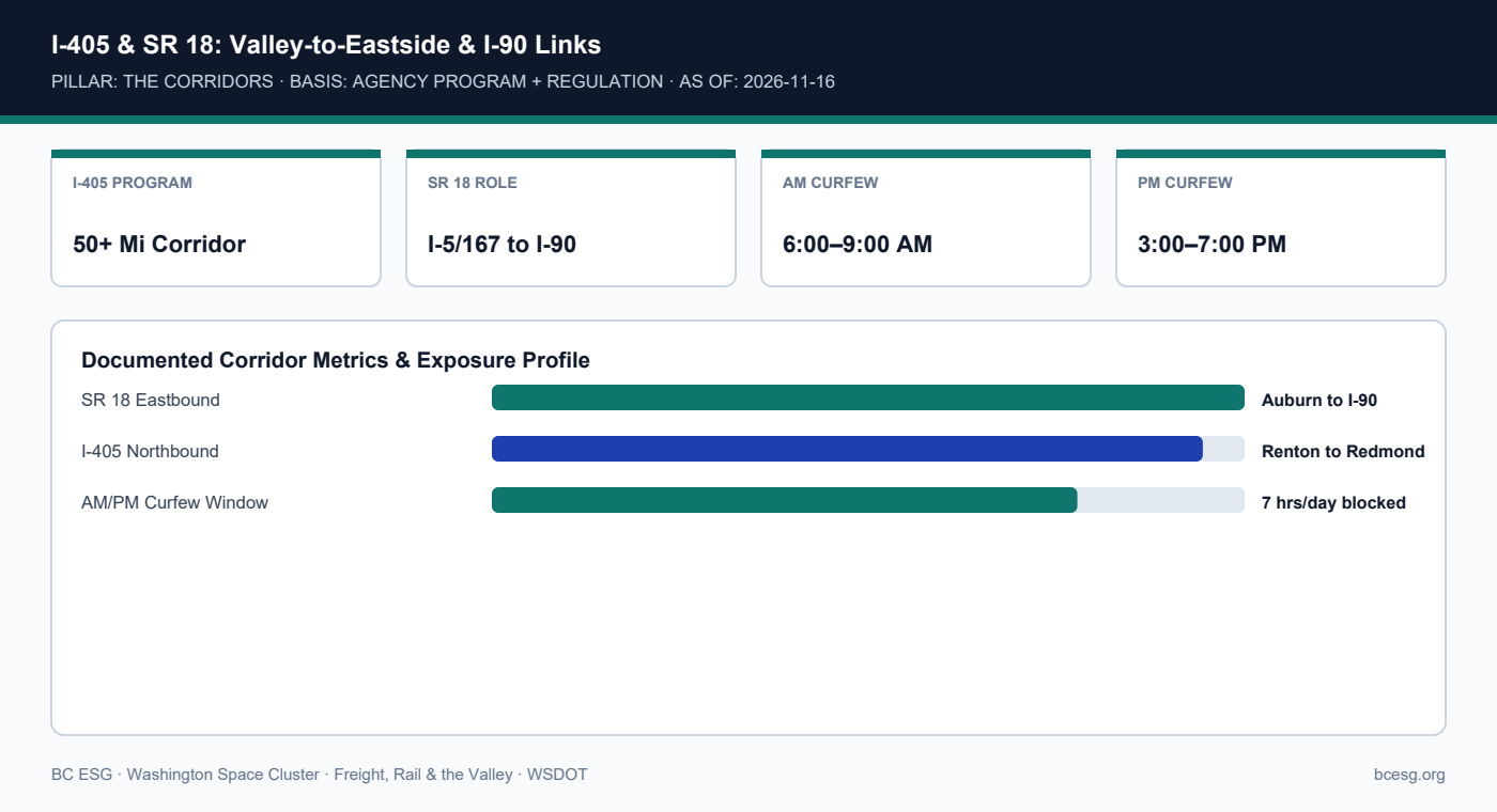
    I-405 connects the Green River Valley north to Redmond and Bothell satellite plants, while SR 18 links Auburn and I-5 eastbound to I-90—both carrying WSDOT peak-hour oversize curfews.
    Primary Agency / Source: WSDOT  |  As-Of / Horizon: 2026-11-16
    FREIGHT, RAIL & VALLEY · PDF & MARKDOWN TWIN
    I-405 & SR 18 Freight Connectors — Reference Brief
    Download the 2-page printable reference PDF or read the clean Markdown twin for AI and engineering workflows.
    I-405 & SR 18: Valley-to-Eastside & I-90 Links
    I-405 & SR 18: Valley-to-Eastside & I-90 Links

    Documented Corridor Facts & Continuity Record

    • WSDOT's I-405/SR 167 Corridor Program spans a 50+-mile network linking South Sound manufacturing hubs (Kent, Auburn, Renton) to Eastside hubs (Bellevue, Redmond, Bothell) and Lynnwood.
    • SR 18 serves as the primary diagonal freight link from Auburn/I-5/SR 167 northeast to I-90 at Snoqualmie.
    • For vehicles requiring 'Oversize Load' signs, WSDOT enforces weekday peak commuter curfews (typically 6:00–9:00 AM and 3:00–7:00 PM) across Seattle-area I-5, I-90, and SR 18.

    I-405 & SR 18 Corridor Constraints for Space Hardware

    CorridorPrimary Space PairOperational ConstraintSource
    I-405 (Renton–Bothell)Kent/Tukwila -> Redmond/BothellHeavy commuter congestion; ETL rulesWSDOT I-405/SR 167
    SR 18 (Auburn–I-90)Kent/Auburn -> Moses Lake (via I-90)6–9 AM & 3–7 PM OSOW curfewsWSDOT CVO

    Operational Exposure & Facility Playbook

    • Schedule oversize deliveries between Kent/Auburn and Moses Lake to clear SR 18 before 6:00 AM or after 7:00 PM on weekdays.
    • When Tukwila/Renton SR 167 floods, SR 18 -> I-90 -> I-405 is the cleanest east-side bypass to reach Redmond and Bothell.
    • Verify vertical bridge clearances on SR 18 and I-405 undercrossings before dispatching tall spacecraft shipping containers.

    Connected Valley Cities, Segments & Role Briefs

    Primary Sources & Agency References

  • Modeled Scenario: Why the Regional Transportation Recovery Annex Shows I-5 Saturated When SR 167 Closes

    Modeled Scenario: Why the Regional Transportation Recovery Annex Shows I-5 Saturated When SR 167 Closes

    MODELED SCENARIO: This is a regional emergency-planning model, not a historical event log. Never blend modeled scenarios with dated events.

    FREIGHT, RAIL & VALLEY · THE CORRIDORS · MODELED SCENARIO (COUNTY ANNEX)
    Modeled I-5 Saturation (Recovery Annex)
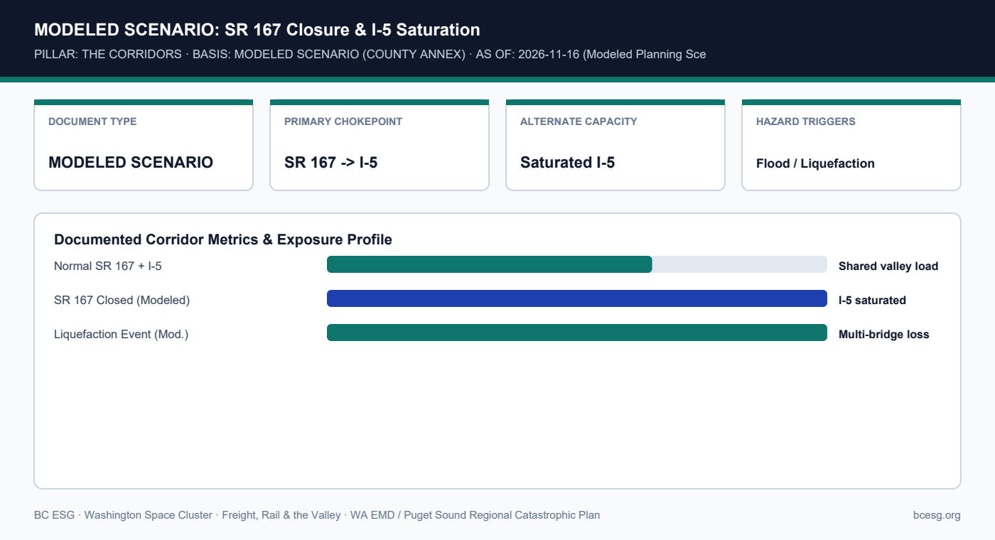
    The Puget Sound Regional Catastrophic Disaster Coordination Plan Transportation Recovery Annex models multi-corridor disruptions where SR 167 closures leave no parallel high-capacity alternate except an already saturated I-5.
    Primary Agency / Source: WA EMD / Puget Sound Regional Catastrophic Plan  |  As-Of / Horizon: 2026-11-16 (Modeled Planning Scenario)
    FREIGHT, RAIL & VALLEY · PDF & MARKDOWN TWIN
    Modeled I-5 Saturation (Recovery Annex) — Reference Brief
    Download the 2-page printable reference PDF or read the clean Markdown twin for AI and engineering workflows.
    MODELED SCENARIO: SR 167 Closure & I-5 Saturation
    MODELED SCENARIO: SR 167 Closure & I-5 Saturation

    Documented Corridor Facts & Continuity Record

    • MODELED SCENARIO: Developed collaboratively by King County and regional partners under the Puget Sound Regional Catastrophic Disaster Coordination Plan.
    • The Transportation Recovery Annex models major roadway disruptions (catastrophic flooding or earthquake-induced liquefaction) affecting north-south valley lifelines.
    • When SR 167 closes in the model, diverted commercial and commuter traffic has no parallel high-capacity freeway alternate except I-5—which saturates rapidly.

    Modeled Scenario vs. Historical Event Separation

    ItemClassificationWhat It EstablishesSource
    Transportation Recovery AnnexMODELED SCENARIOSR 167 closure forces traffic onto saturated I-5WA EMD / King County
    Dec 15, 2025 SR 167 ClosureHISTORICAL EVENT6 miles of SR 167 actually closed on Dec 15, 2025King County / WSDOT
    Detour & Priority ToolboxesPLANNING FRAMEWORKPre-identified alternate routes & priority tiersWA EMD Plans

    Operational Exposure & Facility Playbook

    • Because the Dec 15, 2025 closure validated the Annex's single-corridor dependency in miniature, facilities should treat I-5 gridlock as a certainty during any SR 167 shutdown.
    • Do not assume emergency-priority freight passes are automatic; commercial space hardware requires pre-coordinated staging outside the valley.
    • Keep modeled scenario assumptions clearly labeled in supplier continuity questionnaires so auditors never confuse drills with actual losses.

    Connected Valley Cities, Segments & Role Briefs

    Primary Sources & Agency References

  • SR 167 Completion Project (Puget Sound Gateway): Connecting the Valley to Port of Tacoma by 2029–2030

    SR 167 Completion Project (Puget Sound Gateway): Connecting the Valley to Port of Tacoma by 2029–2030

    Construction stages and target opening dates stated strictly per WSDOT Puget Sound Gateway Program as of 2026-11-16.

    FREIGHT, RAIL & VALLEY · THE CORRIDORS · AGENCY SCHEDULE (AS-OF 2026-11-16)
    SR 167 Completion (Port of Tacoma)
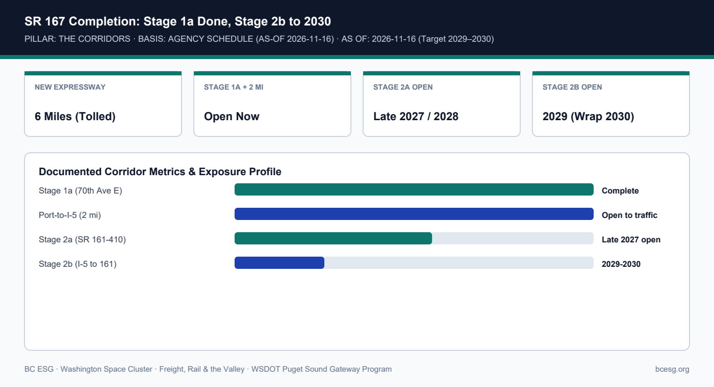
    WSDOT's SR 167 Completion Project builds a 6-mile tolled expressway linking Puyallup to I-5/SR 509 near the Port of Tacoma, with Stage 1a and the first 2 Port-to-I-5 miles open and Stage 2b running through 2029–2030.
    Primary Agency / Source: WSDOT Puget Sound Gateway Program  |  As-Of / Horizon: 2026-11-16 (Target 2029–2030)
    FREIGHT, RAIL & VALLEY · PDF & MARKDOWN TWIN
    SR 167 Completion (Port of Tacoma) — Reference Brief
    Download the 2-page printable reference PDF or read the clean Markdown twin for AI and engineering workflows.
    SR 167 Completion: Stage 1a Done, Stage 2b to 2030
    SR 167 Completion: Stage 1a Done, Stage 2b to 2030

    Documented Corridor Facts & Continuity Record

    • The SR 167 Completion Project closes the missing 6-mile freight gap between Puyallup (existing SR 167) and I-5/SR 509 near the Port of Tacoma.
    • Stage 1a (70th Ave East Bridge over I-5 in Fife) is complete, and the first 2 miles between I-5 and SR 509 near the Port of Tacoma are open.
    • Stage 2a (SR 161 to SR 410, including a diverging diamond interchange) is in progress for late 2027 opening (finishing 2028); Stage 2b (I-5 to SR 161) is scheduled 2026–2030 with 2029 opening.

    WSDOT SR 167 Completion Project Phasing

    StageScopeStatus / TargetFreight Impact
    Stage 1a70th Ave E Bridge over I-5 (Fife)CompleteImproved I-5 port access
    Port-to-I-5 Segment2 miles I-5 to SR 509 / 54th Ave EOpenDirect Port of Tacoma link
    Stage 2aSR 161 to SR 410 widening + DDI2025–2028 (Open late 2027)Removes Puyallup bottleneck
    Stage 2bI-5 to SR 161 new expressway2026–2030 (Open 2029)Completes valley-to-port link

    Operational Exposure & Facility Playbook

    • Until Stage 2b opens in 2029, Tacoma breakbulk and container drayage from Kent/Auburn still funnel through congested I-5/Fife interchanges.
    • Factor active 2026–2029 construction detours and lane closures around Fife/Puyallup into heavy-haul OSOW permit routing.
    • Once complete, Stage 2b gives Green River Valley space manufacturers a direct expressway corridor to Tacoma's East Blair 1 / Terminal 7 breakbulk berths.

    Connected Valley Cities, Segments & Role Briefs

    Primary Sources & Agency References

  • SR 167: The Green River Valley’s Primary Freight Spine and Its Dec 2025 Six-Mile Closure

    SR 167: The Green River Valley’s Primary Freight Spine and Its Dec 2025 Six-Mile Closure

    Dec 15, 2025 6-mile closure is a dated historical event; I-405/SR 167 improvements per WSDOT.

    FREIGHT, RAIL & VALLEY · THE CORRIDORS · HISTORICAL EVENT + AGENCY PROGRAM
    SR 167 Valley Freight Spine
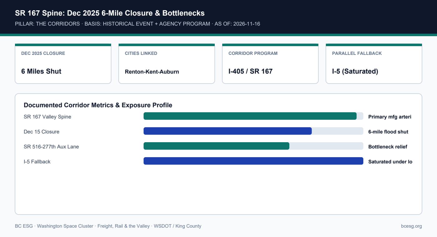
    SR 167 is the north-south industrial lifeline linking Renton, Kent, and Auburn; on December 15, 2025, the Desimone levee breach forced a 6-mile closure of SR 167, pushing valley freight onto an already saturated I-5.
    Primary Agency / Source: WSDOT / King County  |  As-Of / Horizon: 2026-11-16
    FREIGHT, RAIL & VALLEY · PDF & MARKDOWN TWIN
    SR 167 Valley Freight Spine — Reference Brief
    Download the 2-page printable reference PDF or read the clean Markdown twin for AI and engineering workflows.
    SR 167 Spine: Dec 2025 6-Mile Closure & Bottlenecks
    SR 167 Spine: Dec 2025 6-Mile Closure & Bottlenecks

    Documented Corridor Facts & Continuity Record

    • SR 167 runs directly along the Green River Valley floor through Renton, Kent, and Auburn, serving the state's densest concentration of aerospace and warehouse docks.
    • When the Desimone Levee breached on December 15, 2025, authorities closed a 6-mile stretch of SR 167.
    • WSDOT's I-405/SR 167 Corridor Program and auxiliary-lane projects (such as SR 516 to S 277th St) aim to relieve merging bottlenecks, but do not eliminate flood-closure exposure.

    SR 167 Valley Segment Operational Profile

    Segment / ProjectFunctionVulnerability / StatusSource
    Renton-Kent-Auburn CorePrimary valley truck & shift spineClosed 6 miles Dec 15, 2025King County / WSDOT
    SR 516 to S 277th St AuxMerge/diverge bottleneck reliefDeployed operational fixWSDOT I-405/SR 167
    Electronic Toll ModernizationExpress toll lane managementCompleted across active ETLWSDOT

    Operational Exposure & Facility Playbook

    • Dispatchers must treat SR 167 as a single-point floodable arterial during atmospheric-river warnings.
    • Pre-register alternate surface-street truck routes (e.g., West Valley Hwy / East Valley Hwy where weight-legal) while checking local bridge postings.
    • Coordinate shift-change flexibility when SR 167 closes, as 65,000 valley workers compete for I-5 and surface arterials.

    Connected Valley Cities, Segments & Role Briefs

    Primary Sources & Agency References

  • The 2026–2031 Valley Levee Repair Horizon: Tracking Desimone, Pacific, and Interim Risk

    The 2026–2031 Valley Levee Repair Horizon: Tracking Desimone, Pacific, and Interim Risk

    Repair timelines stated strictly as agencies state them as of 2026-11-16; infrastructure schedules move and must be re-checked.

    FREIGHT, RAIL & VALLEY · THE VALLEY · AGENCY SCHEDULE (AS-OF 2026-11-16)
    2026–2031 Levee Repair Horizon
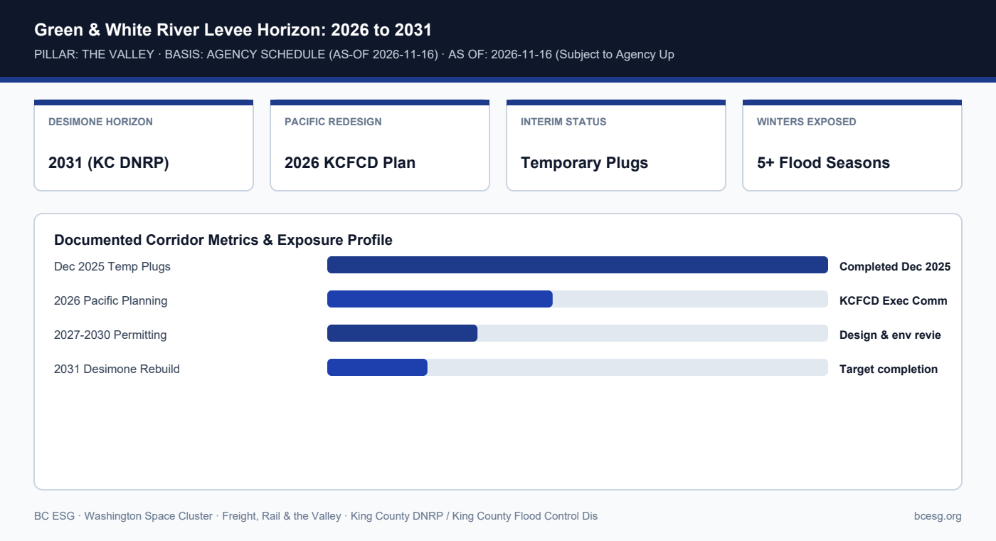
    King County DNRP planning places permanent structural reconstruction of the breached Desimone Levee out toward 2031, while Pacific's White River corridor transitioned into 2026 KCFCD recovery redesign—leaving multi-winter interim exposure.
    Primary Agency / Source: King County DNRP / King County Flood Control District  |  As-Of / Horizon: 2026-11-16 (Subject to Agency Updates)
    FREIGHT, RAIL & VALLEY · PDF & MARKDOWN TWIN
    2026–2031 Levee Repair Horizon — Reference Brief
    Download the 2-page printable reference PDF or read the clean Markdown twin for AI and engineering workflows.
    Green & White River Levee Horizon: 2026 to 2031
    Green & White River Levee Horizon: 2026 to 2031

    Documented Corridor Facts & Continuity Record

    • Infrastructure timelines move; as of November 2026, King County DNRP planning documents place full-scale permanent reconstruction of the Desimone Levee out toward 2031.
    • The Desimone Levee had already sustained significant damage in 2020 floods before breaching again on December 15, 2025.
    • In Pacific, the King County Flood Control District Executive Committee transitioned permanent White River levee replacement into 2026 recovery planning discussions.

    Documented Valley Levee & Corridor Repair Horizons (As of 2026-11-16)

    Project / ReachCurrent StateStated HorizonSource Agency
    Desimone Levee (Tukwila)Temporary rock/sandbag plugToward 2031King County DNRP
    White River Levee (Pacific)Emergency reinforcement post-Dec 162026+ KCFCD planningKCFCD Exec Committee
    SR 167 Stage 2a (Pierce)Under constructionLate 2027 / 2028WSDOT Gateway
    SR 167 Stage 2b (Pierce)Scheduled 2026–20302029 open / 2030 wrapWSDOT Gateway

    Operational Exposure & Facility Playbook

    • Space companies signing 5-year valley leases in 2026–2027 will operate through the entire Desimone 2031 interim repair window.
    • Review King County Flood Services project dashboards annually before each October flood season.
    • Build the 2031 interim risk window into customer continuity disclosures and property-insurance renewals.

    Connected Valley Cities, Segments & Role Briefs

    Primary Sources & Agency References

  • Valley Floor Power, Substations & Cleanroom Continuity During Flood Events

    Valley Floor Power, Substations & Cleanroom Continuity During Flood Events

    Operational engineering guidance grounded in King County floodplain standards; specific utility feeder maps per facility are not in our data.

    FREIGHT, RAIL & VALLEY · THE VALLEY · OPERATIONAL PLAYBOOK + AGENCY CONTEXT
    Valley Power & Cleanroom Continuity
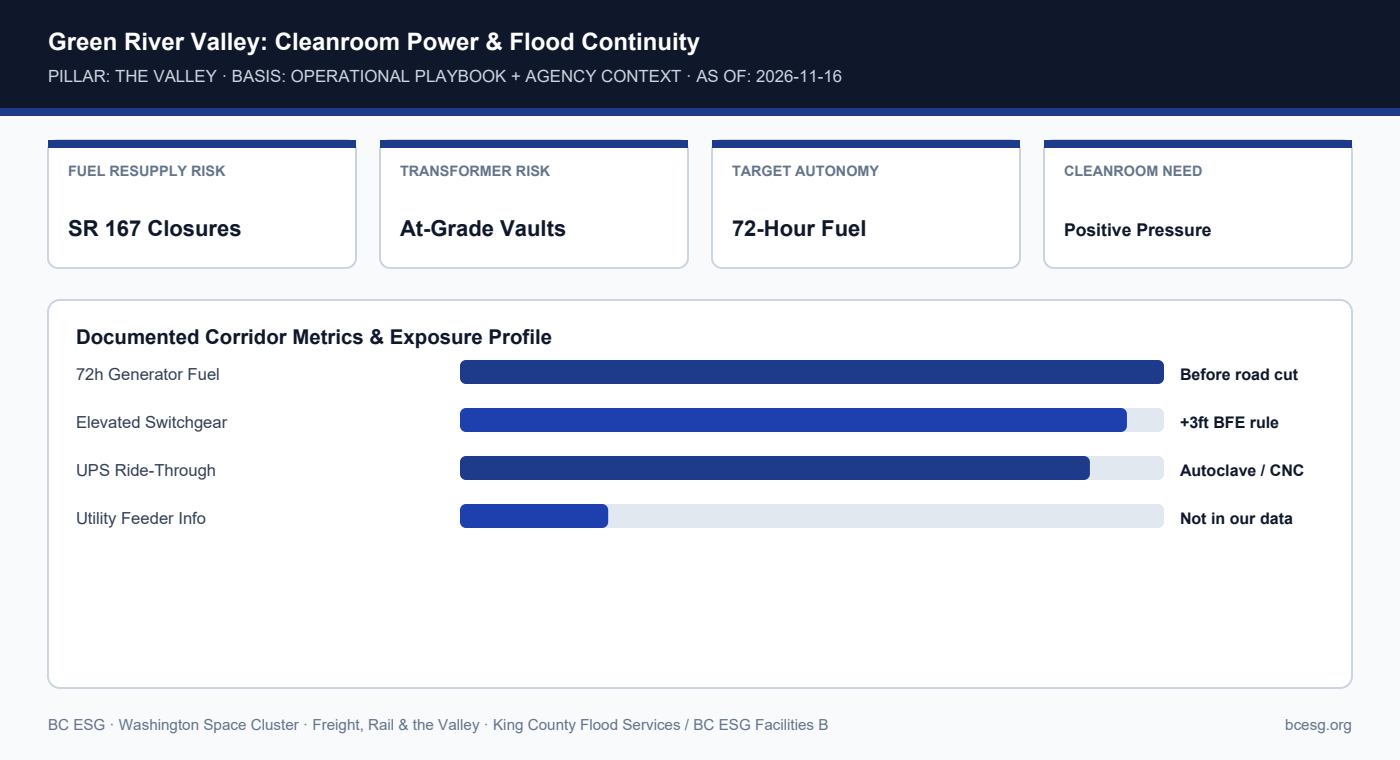
    Satellite cleanrooms, autoclaves, and additive-manufacturing cells in Kent and Tukwila cannot tolerate unscheduled power drops; valley flood events threaten at-grade transformers, fuel deliveries, and utility access.
    Primary Agency / Source: King County Flood Services / BC ESG Facilities Briefs  |  As-Of / Horizon: 2026-11-16
    FREIGHT, RAIL & VALLEY · PDF & MARKDOWN TWIN
    Valley Power & Cleanroom Continuity — Reference Brief
    Download the 2-page printable reference PDF or read the clean Markdown twin for AI and engineering workflows.
    Green River Valley: Cleanroom Power & Flood Continuity
    Green River Valley: Cleanroom Power & Flood Continuity

    Documented Corridor Facts & Continuity Record

    • Specific PSE/Seattle City Light substation feeder maps for individual private space facilities are not in our data and must be verified per site.
    • What is documented is that SR 167 closures (such as Dec 15, 2025) sever diesel fuel-truck resupply routes for valley-floor backup generators.
    • Facilities running ISO Class 7/8 cleanrooms, vacuum chambers, or thermal-vac tests require 72-hour on-site fuel autonomy and elevated transfer switches.

    Valley Facility Utility Continuity Controls

    SystemFlood / Corridor Failure ModeControlVerification
    Diesel GeneratorsFuel truck blocked by SR 167 closureMaintain >=72h on-site fuelPre-storm top-off trigger
    Pad-Mount TransformersStanding water / vault intrusionSandbag perimeter + elevation checkKCC 21A.24 Elevation Cert
    Autoclaves / CleanroomsGrid sag during atmospheric riversUPS + automatic transfer switchMonthly load-bank test

    Operational Exposure & Facility Playbook

    • Set an automatic fuel-top-off trigger whenever Green River flow forecasts reach Phase 2 flood alert.
    • Verify that generator exhaust, day-tank vents, and fuel fill ports sit above the documented 100-year flood elevation.
    • Cross-reference WA CBPS / Seattle BEPS compliance (#1984) so backup-power retrofits align with building-energy reporting.

    Connected Valley Cities, Segments & Role Briefs

    Primary Sources & Agency References

  • KCC 21A.24 Zero-Rise & +3ft Base Flood Elevation: How Floodplain Rules Govern Space Plant Expansion

    KCC 21A.24 Zero-Rise & +3ft Base Flood Elevation: How Floodplain Rules Govern Space Plant Expansion

    Links directly to BC ESG Batch 5 Rule #1993 and Batch 6 Facilities/EHS brief #2067.

    FREIGHT, RAIL & VALLEY · THE VALLEY · AGENCY REGULATION
    KCC 21A.24 Zero-Rise & +3ft BFE
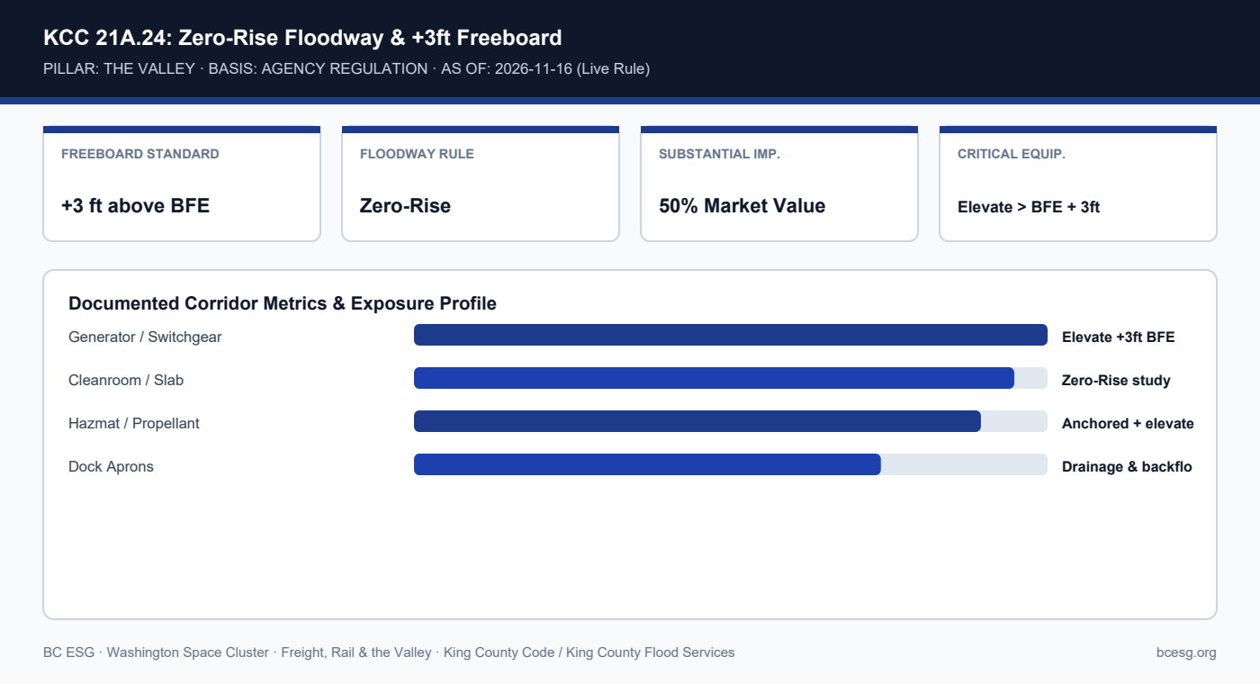
    King County Code 21A.24 enforces Zero-Rise floodway standards and +3 feet above Base Flood Elevation (BFE) freeboard—directly governing cleanroom expansions, test-cell pads, and backup-generator placement in the valley.
    Primary Agency / Source: King County Code / King County Flood Services  |  As-Of / Horizon: 2026-11-16 (Live Rule)
    FREIGHT, RAIL & VALLEY · PDF & MARKDOWN TWIN
    KCC 21A.24 Zero-Rise & +3ft BFE — Reference Brief
    Download the 2-page printable reference PDF or read the clean Markdown twin for AI and engineering workflows.
    KCC 21A.24: Zero-Rise Floodway & +3ft Freeboard
    KCC 21A.24: Zero-Rise Floodway & +3ft Freeboard

    Documented Corridor Facts & Continuity Record

    • King County Code 21A.24 (and municipal equivalents in Kent, Tukwila, and Auburn) requires structures in mapped floodplains to meet +3 feet above Base Flood Elevation (BFE) and Zero-Rise floodway rules.
    • Tenant improvements exceeding 50% of structure market value can trigger full substantial-improvement elevation compliance.
    • External backup generators, cryo tanks, and electrical switchgear placed at grade risk flood inundation unless mounted on elevated steel/concrete platforms.

    KCC 21A.24 Siting & Tenant-Improvement Checklist

    Facility ElementFloodplain ConstraintEngineering MitigationReference
    Backup Generators & UPSAt-grade pads flood firstMount >= BFE + 3 ftKCC 21A.24 / Rule #1993
    Outdoor Cryo / Gas TanksBuoyancy & float-off hazardEngineered anchoring + elevationKCC 21A.24 / WAC 173-303
    New Bay / Test AnnexZero-Rise compensatory storageBalanced cut/fill hydraulic studyKing County Flood Services

    Operational Exposure & Facility Playbook

    • Before signing a Green River Valley industrial lease, request the Elevation Certificate and floodway/flood-fringe boundary map.
    • Confirm with Facilities/EHS (#2067) that hazardous waste accumulation areas under WAC 173-303 have secondary containment above flood stage.
    • Factor hydraulic-study permitting lead time into CapEx schedules for new test-stand pads.

    Connected Valley Cities, Segments & Role Briefs

    Primary Sources & Agency References

  • Tukwila & Renton: The Valley’s North Gate Where Desimone, I-405, and 737 Rail Meet

    Tukwila & Renton: The Valley’s North Gate Where Desimone, I-405, and 737 Rail Meet

    Census locations from #1394 (Renton) and #1397 (Tukwila); Desimone breach dated Dec 15, 2025.

    FREIGHT, RAIL & VALLEY · THE VALLEY · HISTORICAL EVENT + CENSUS
    Tukwila & Renton North Valley Gate
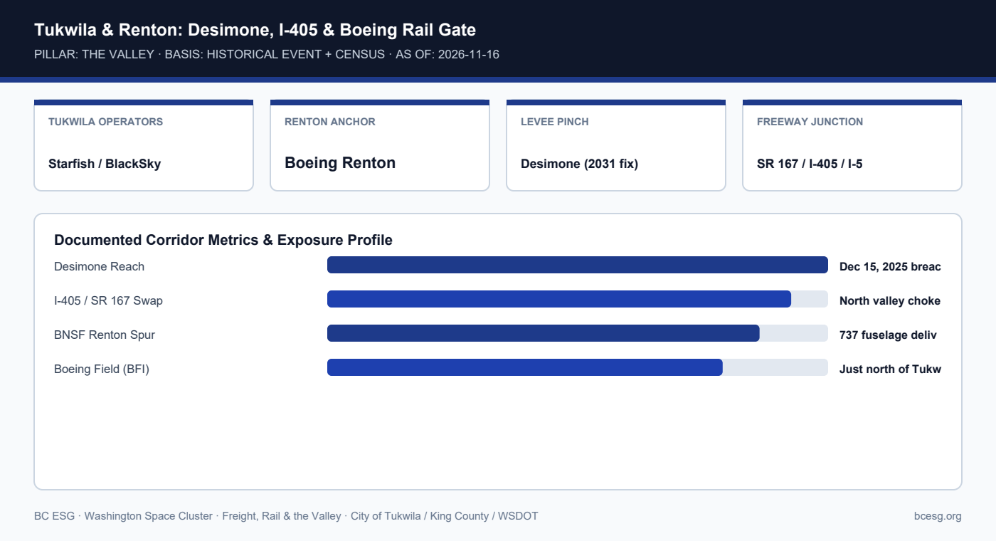
    Tukwila and Renton form the northern neck of the Green River Valley—hosting Starfish Space, BlackSky, The Radiation Team, Boeing Renton, and the Desimone Levee reach where SR 167 meets I-405 and BNSF.
    Primary Agency / Source: City of Tukwila / King County / WSDOT  |  As-Of / Horizon: 2026-11-16
    FREIGHT, RAIL & VALLEY · PDF & MARKDOWN TWIN
    Tukwila & Renton North Valley Gate — Reference Brief
    Download the 2-page printable reference PDF or read the clean Markdown twin for AI and engineering workflows.
    Tukwila & Renton: Desimone, I-405 & Boeing Rail Gate
    Tukwila & Renton: Desimone, I-405 & Boeing Rail Gate

    Documented Corridor Facts & Continuity Record

    • Tukwila hosts Starfish Space (665 Andover Park W), BlackSky, and The Radiation Team (Tukwila/Renton), while Renton hosts Boeing's 737 assembly line and space-adjacent precision shops.
    • The Desimone Levee in Tukwila is the northern hydraulic bottleneck; its Dec 15, 2025 breach drove evacuation orders across Tukwila, Kent, and Renton.
    • Northbound freight exiting the valley funnels through the I-405 / SR 167 interchange or crosses to I-5—both adjacent to Boeing Field (BFI).

    Tukwila & Renton North-Gate Chokepoints

    NodeLocationRoleDocumented Risk
    Desimone LeveeTukwila (Green River)Protects north valley floorBreached Dec 15, 2025; 2031 fix
    SR 167 / I-405 InterchangeRenton / TukwilaValley-to-Eastside connectorWSDOT I-405/SR 167 program
    BNSF Renton BranchRentonDelivers 737 fuselagesSingle-track urban rail spur

    Operational Exposure & Facility Playbook

    • Eastside Redmond/Bothell/Bellevue satellite firms receiving parts from Kent/Auburn suppliers depend on the Tukwila-Renton I-405 gate staying open.
    • During Green River Phase 3/4 flood alerts, route Kent-to-Redmond vans via SR 18 -> I-90 -> I-405 rather than SR 167 north through Tukwila.
    • Coordinate BFI air-charter pickups with Tukwila local street flood closures along Interurban Ave / East Marginal Way.

    Connected Valley Cities, Segments & Role Briefs

    Primary Sources & Agency References

  • Auburn’s Dual-River Pinch: Green River, White River, and BNSF Auburn Yard

    Auburn’s Dual-River Pinch: Green River, White River, and BNSF Auburn Yard

    Auburn Census (#1391) documents 0 core and 2 adjacent space operators (Tessera, Orion); rail and flood facts from WSDOT and KCFCD.

    FREIGHT, RAIL & VALLEY · THE VALLEY · HISTORICAL EVENT + AGENCY FIGURE
    Auburn Dual-River & Rail Junction
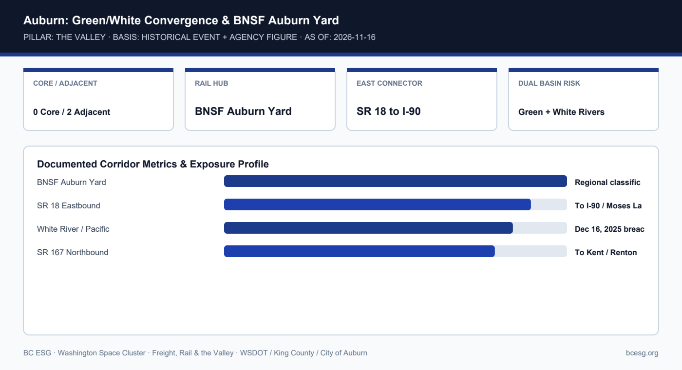
    Sitting at the convergence of the Green and White river valleys, Auburn hosts BNSF's Auburn Yard and space-adjacent precision suppliers—exposing it to both Green River levee events and White River/Pacific breaches.
    Primary Agency / Source: WSDOT / King County / City of Auburn  |  As-Of / Horizon: 2026-11-16
    FREIGHT, RAIL & VALLEY · PDF & MARKDOWN TWIN
    Auburn Dual-River & Rail Junction — Reference Brief
    Download the 2-page printable reference PDF or read the clean Markdown twin for AI and engineering workflows.
    Auburn: Green/White Convergence & BNSF Auburn Yard
    Auburn: Green/White Convergence & BNSF Auburn Yard

    Documented Corridor Facts & Continuity Record

    • Auburn sits at the south end of the Green River Valley near the White River convergence, just north of the December 16, 2025 Pacific levee breach.
    • BNSF's Auburn Yard—located south of SR 18 and east of SR 167—is a primary Pacific Northwest classification yard and the western staging gateway for Stampede Pass.
    • Per BC ESG's frozen Census (#1391), Auburn hosts 0 core space companies and 2 space-adjacent aerospace/precision suppliers (Tessera and Orion Industries).

    Auburn Valley Convergence: Corridors & Flood Exposure

    InfrastructureFunctionFlood / Disruption ExposureSource
    BNSF Auburn YardCar classification & Stampede stagingHistoric Green/White floodplainWSDOT Rail Plan
    SR 18 CorridorLinks I-5 / SR 167 east to I-90Commuter curfews + pass weatherWSDOT CVO
    White River (Pacific)South boundary inflowDec 16, 2025 ~120-ft breachKCFCD / USACE

    Operational Exposure & Facility Playbook

    • Auburn suppliers feeding Kent and Renton primes sit directly between the Dec 15 Desimone breach (north) and Dec 16 Pacific breach (south).
    • SR 18 is the critical eastbound bypass from Auburn toward I-90 and Moses Lake, but carries peak commuter curfews for oversize loads.
    • Verify supplier-pickup windows in Auburn against both Green and White River flood-phase alerts.

    Connected Valley Cities, Segments & Role Briefs

    Primary Sources & Agency References

  • Kent’s Space Cluster on the Valley Floor: Levee Reach, SR 167 Access, and Pad Elevation

    Kent’s Space Cluster on the Valley Floor: Levee Reach, SR 167 Access, and Pad Elevation

    Company locations from BC ESG Census (#1388); flood exposure bounded to King County floodplain and Dec 2025 SR 167 closure records.

    FREIGHT, RAIL & VALLEY · THE VALLEY · AGENCY FIGURE + CENSUS
    Kent Valley Floor & Levee Exposure
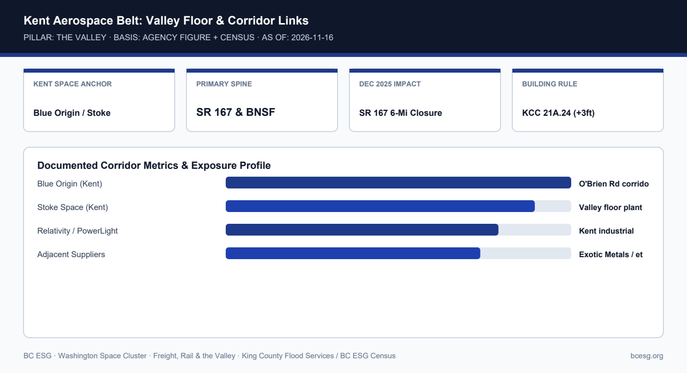
    Kent anchors the Green River Valley's highest concentration of launch and propulsion hardware—including Blue Origin, Stoke Space, Relativity Space, and PowerLight—all sharing the SR 167 and BNSF valley floor.
    Primary Agency / Source: King County Flood Services / BC ESG Census  |  As-Of / Horizon: 2026-11-16
    FREIGHT, RAIL & VALLEY · PDF & MARKDOWN TWIN
    Kent Valley Floor & Levee Exposure — Reference Brief
    Download the 2-page printable reference PDF or read the clean Markdown twin for AI and engineering workflows.
    Kent Aerospace Belt: Valley Floor & Corridor Links
    Kent Aerospace Belt: Valley Floor & Corridor Links

    Documented Corridor Facts & Continuity Record

    • Kent hosts Blue Origin, Stoke Space, Relativity Space, PowerLight Technologies, and space-adjacent Exotic Metals Forming on the Green River Valley floor.
    • While the Dec 15, 2025 Desimone breach occurred just north in Tukwila, evacuation orders spanned Kent, Renton, and Tukwila, and the 6-mile SR 167 closure severed north-bound valley freight.
    • King County Code 21A.24 requires Zero-Rise floodway compliance and +3 feet above Base Flood Elevation (BFE) for new/substantially improved structures in mapped floodplains.

    Kent Valley Space Cluster Corridor Dependencies

    Corridor / AssetRole for Kent FacilitiesDocumented VulnerabilityPrimary Source
    SR 167 ExpresswayNorth-south freight & shift spineClosed 6 miles Dec 15, 2025King County / WSDOT
    BNSF Valley MainlineHeavy rail & transcontinental linkShares valley floor gradeWSDOT / BNSF
    Green River Levee SystemFlood protection for industrial parksDesimone fix delayed to 2031King County DNRP
    I-5 Fallback (Modeled)Only parallel north-south freewaySaturated in County AnnexWA EMD Recovery Annex

    Operational Exposure & Facility Playbook

    • Kent facilities on high-bay concrete pads often survive shallow street flooding, yet lose outbound truck windows and second-shift staffing when SR 167 closes.
    • Audit dock-apron elevations, sump pump backup power, and hazardous-material storage (WAC 173-303) above +3 ft BFE.
    • Maintain pre-approved east-west escape routes via SR 516 / Kent-Kangley or SR 18 toward I-90 when SR 167 floods.

    Connected Valley Cities, Segments & Role Briefs

    Primary Sources & Agency References

  • The Valley’s $46M/Day Arithmetic: How King County Measures Green River Floodplain Exposure

    The Valley’s $46M/Day Arithmetic: How King County Measures Green River Floodplain Exposure

    All dollar, job, and GDP share figures are attributed directly to King County and King County Flood Control District.

    FREIGHT, RAIL & VALLEY · THE VALLEY · AGENCY FIGURE
    Valley $46M/Day Economic Arithmetic
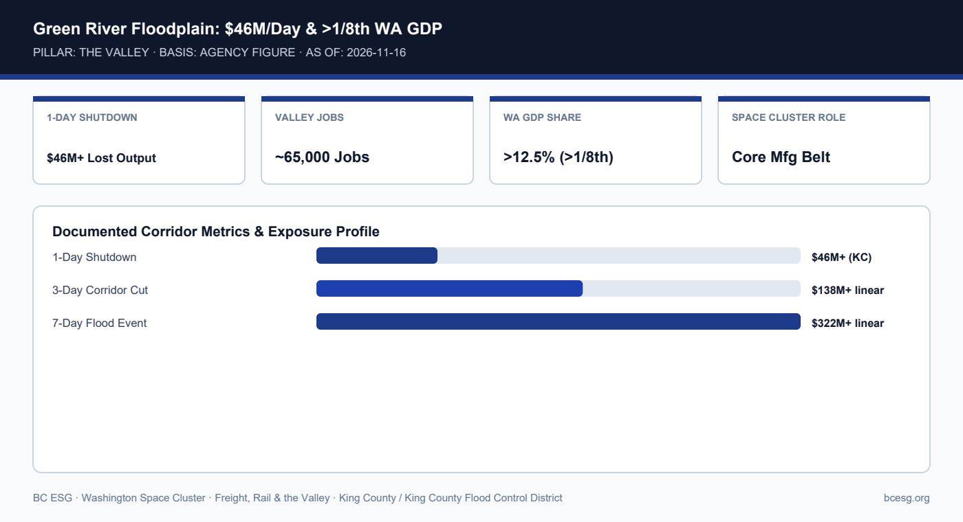
    King County calculates that a single-day shutdown in its floodplains costs at least $46M in lost economic output across a Green River Valley corridor supporting ~65,000 jobs and over one-eighth of Washington State GDP.
    Primary Agency / Source: King County / King County Flood Control District  |  As-Of / Horizon: 2026-11-16
    FREIGHT, RAIL & VALLEY · PDF & MARKDOWN TWIN
    Valley $46M/Day Economic Arithmetic — Reference Brief
    Download the 2-page printable reference PDF or read the clean Markdown twin for AI and engineering workflows.
    Green River Floodplain: $46M/Day & >1/8th WA GDP
    Green River Floodplain: $46M/Day & >1/8th WA GDP

    Documented Corridor Facts & Continuity Record

    • King County reports that Green River Valley businesses generate more than one-eighth of Washington State's total GDP and support roughly 65,000 jobs.
    • King County estimates a one-day shutdown of floodplain economic activity costs at least $46M in lost regional output.
    • Linear multi-day arithmetic ($46M × N days) is a minimum floor; actual aerospace schedule penalties compound when cleanrooms, autoclaves, or test stands lose power or inbound parts.

    King County Floodplain Economic Exposure Metrics

    MetricPublished FigureAttributionNotes for Space Suppliers
    Daily Floodplain Output LossAt least $46M/dayKing County / KCFCDMinimum 1-day shutdown floor
    Regional Employment Base~65,000 jobsKing CountyIncludes mfg, logistics, retail
    Statewide GDP Concentration>1/8th of WA GDPKing CountySingle valley drives >12.5% of state

    Operational Exposure & Facility Playbook

    • Use King County's $46M/day figure when justifying backup generators, elevated racking, and dual-corridor carrier contracts to finance leads.
    • Do not conflate valley-wide output with space-sector-only output; space companies are a high-value subset alongside Boeing, distribution centers, and retail.
    • Link business-interruption insurance sublimits (flood vs. contingent business interruption from SR 167 closure) to documented daily burn.

    Connected Valley Cities, Segments & Role Briefs

    Primary Sources & Agency References

  • The 2009 Hanson Dam Seepage Scare: What Actually Happened and the 26-Mile Valley Sandbag Record

    The 2009 Hanson Dam Seepage Scare: What Actually Happened and the 26-Mile Valley Sandbag Record

    Primary-source correction: KCFCD funded 26 miles of temporary barriers valley-wide (multi-million-dollar effort including removal), superseding informal '$1.5M / 12 miles in Kent' shorthand.

    FREIGHT, RAIL & VALLEY · THE VALLEY · HISTORICAL EVENT (CORRECTED)
    2009 Hanson Dam Seepage & 26-Mi Defense
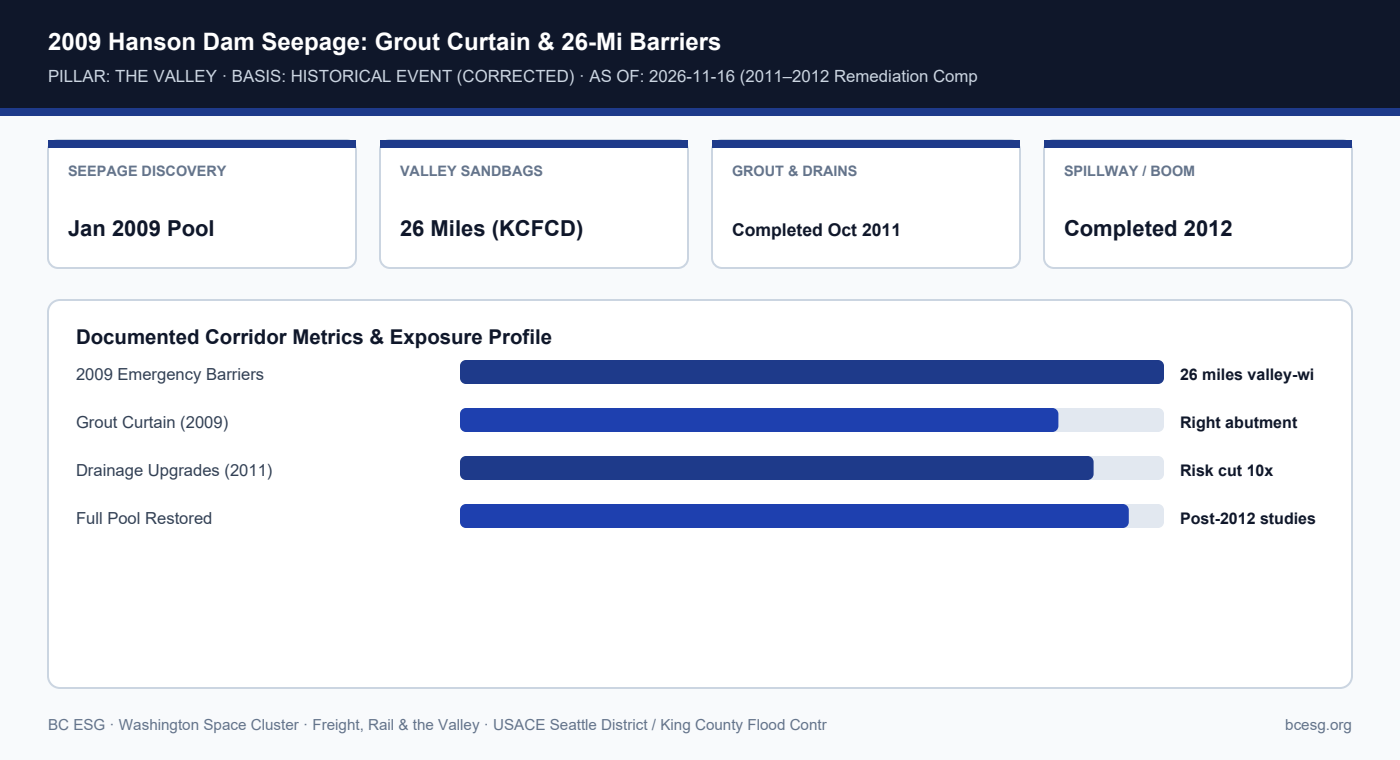
    After a record January 2009 pool revealed right-abutment seepage and sinkholes at Howard A. Hanson Dam, USACE built a grout curtain and drainage system (2009–2012) while King County Flood Control District funded 26 miles of temporary sandbag barriers.
    Primary Agency / Source: USACE Seattle District / King County Flood Control District  |  As-Of / Horizon: 2026-11-16 (2011–2012 Remediation Complete)
    FREIGHT, RAIL & VALLEY · PDF & MARKDOWN TWIN
    2009 Hanson Dam Seepage & 26-Mi Defense — Reference Brief
    Download the 2-page printable reference PDF or read the clean Markdown twin for AI and engineering workflows.
    2009 Hanson Dam Seepage: Grout Curtain & 26-Mi Barriers
    2009 Hanson Dam Seepage: Grout Curtain & 26-Mi Barriers

    Documented Corridor Facts & Continuity Record

    • Following a record-high pool in January 2009, USACE engineers discovered two sinkholes/depressions and sediment-laden water entering the right-abutment drainage tunnel at Howard A. Hanson Dam.
    • While USACE restricted storage and built a subsurface grout curtain (late 2009) plus filtered drains (completed October 2011) and spillway/log-boom upgrades (2012), the valley faced elevated flood odds.
    • Primary-source check vs. frame-research shorthand: King County Flood Control District funded 26 miles of temporary industrial sandbag/super-sack barriers across Kent, Auburn, and Tukwila—far exceeding '12 miles / $1.5M in Kent'—with removal alone costing several million dollars.

    2009 Hanson Dam Seepage: Frame Shorthand vs. Primary-Source Record

    ItemFrame NotePrimary-Source RecordAuthority
    Abutment Seepage2009 seepage scareJan 2009 pool; 2 sinkholes, muddy tunnel flowUSACE Seattle District
    Temporary BarriersKent $1.5M / 12 miles26 miles funded valley-wide; multi-$M removalKCFCD / Local Press
    Permanent Dam FixNot stated in shorthand2009 grout curtain; Oct 2011 drains; 2012 upgradesUSACE Seattle District
    Current Dam Status1-in-4 odds (2009 season)Max pool capacity safely restored post-2012USACE Final Safety Studies

    Operational Exposure & Facility Playbook

    • The 2009 episode proves that even before a levee breaches, a dam storage restriction forces valley-wide emergency barriers and multi-year disruption.
    • USACE final dam-safety studies confirmed the 2009–2012 abutment remediation reduced risk by an order of magnitude and restored full pool capacity.
    • Facilities teams should preserve institutional memory of 2009 staging footprints—knowing which access roads hosted super-sacks prevents dock blockages.

    Connected Valley Cities, Segments & Role Briefs

    Primary Sources & Agency References

BC ESG

ESG Strategy, Sustainability Intelligence, and Business Continuity for Forward-Thinking Organizations

© 2026 BC ESG — Business Continuity, ESG & Sustainability Intelligence