Category: Space Cluster Freight & Valley

Green River Valley floodplains, SR 167/I-5/I-90/BNSF/NWSA corridors, space-hardware movement precedents, and corridor-closure operational playbooks for Washington’s space cluster.

  • The Moses Lake Test Corridor (MWH): Moving Hardware From Puget Sound to Grant County

    The Moses Lake Test Corridor (MWH): Moving Hardware From Puget Sound to Grant County

    Stoke Space's Moses Lake test presence is documented in Census #1409 & #1415; Stoke's specific carrier contracts and truck schedules are NOT IN OUR DATA.

    FREIGHT, RAIL & VALLEY · SPACE HARDWARE · CENSUS + AGENCY CONTEXT (BOUNDARY NOTED)
    Moses Lake (MWH) Test Corridor
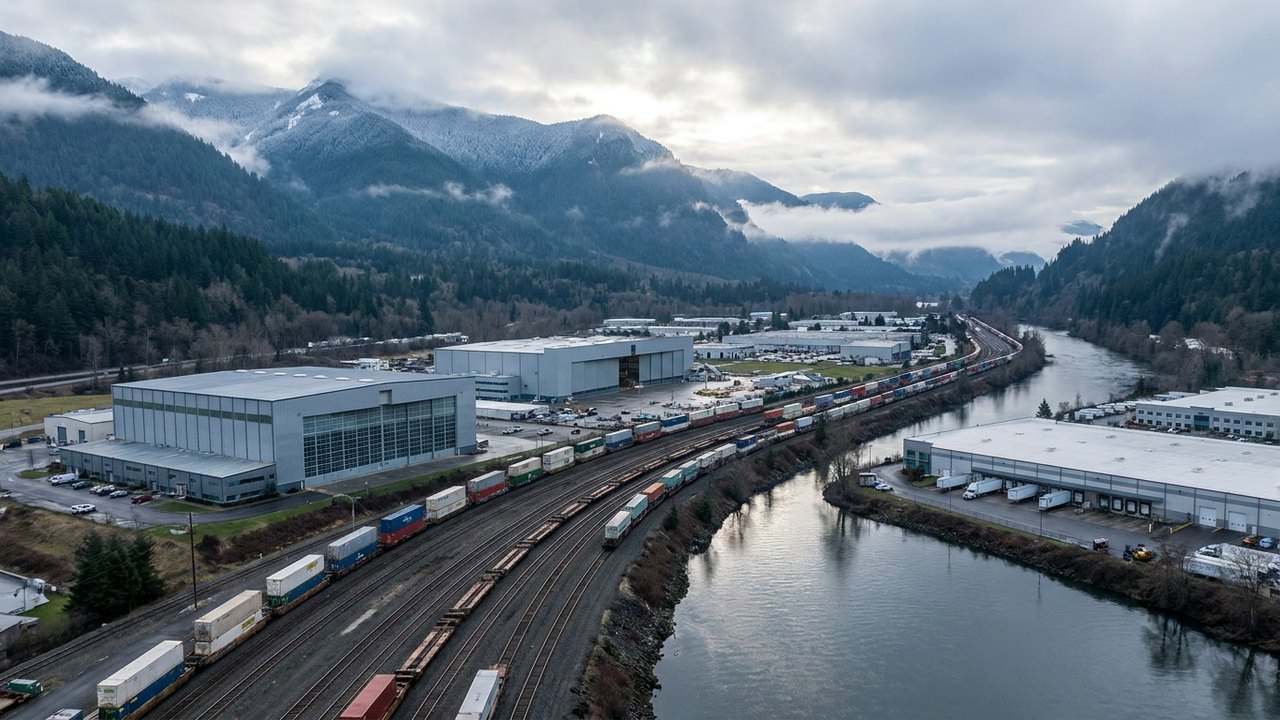
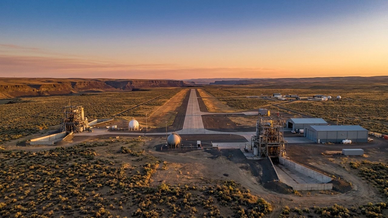
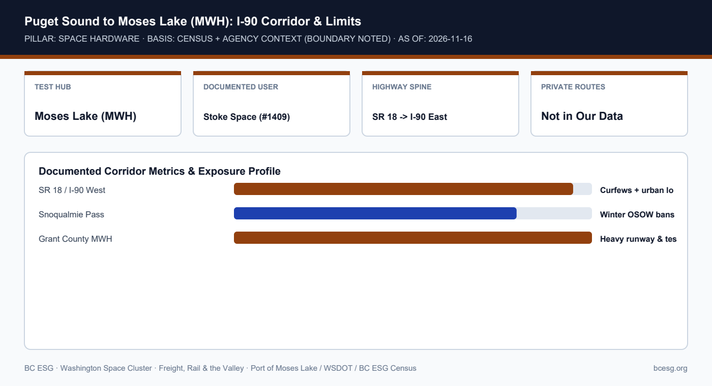
    Moses Lake's Grant County International Airport (MWH) anchors eastern Washington flight and propulsion testing (including Stoke Space's documented test site), connected to Kent solely via SR 18 / I-90 over Snoqualmie Pass.
    Primary Agency / Source: Port of Moses Lake / WSDOT / BC ESG Census  |  As-Of / Horizon: 2026-11-16
    FREIGHT, RAIL & VALLEY · PDF & MARKDOWN TWIN
    Moses Lake (MWH) Test Corridor — Reference Brief
    Download the 2-page printable reference PDF or read the clean Markdown twin for AI and engineering workflows.
    Puget Sound to Moses Lake (MWH): I-90 Corridor & Limits
    Puget Sound to Moses Lake (MWH): I-90 Corridor & Limits

    Documented Corridor Facts & Continuity Record

    • BC ESG Census #1409 (Moses Lake) and #1415 (Stoke Space) document Stoke Space's rocket-testing operations at Moses Lake alongside Kent manufacturing.
    • Port of Moses Lake (Grant County International Airport, MWH) provides long-runway air-cargo capacity and remote test infrastructure east of the Cascades.
    • NOT IN OUR DATA: Exact truck-by-truck routes, third-party heavy-haul carrier names, and shipment frequencies used by Stoke Space or other private operators are not publicly documented and are not reconstructed here.

    Puget Sound to Moses Lake Corridor: Documented vs. Not-In-Our-Data

    ElementStatusDetail
    MWH Test Site PresenceDocumented (#1409/#1415)Stoke Space test operations at Moses Lake
    Public Highway LinkDocumented (WSDOT)SR 18 / I-90 over Snoqualmie Pass (curfews + chain bans)
    Private Carrier / SchedulesNOT IN OUR DATANo public manifest of company-specific truck routes

    Operational Exposure & Facility Playbook

    • Any program relying on Puget Sound manufacturing + Moses Lake testing depends on I-90 Snoqualmie Pass staying open to oversize loads.
    • Winter test campaigns should pre-position spares and ground-support equipment at MWH before November pass restrictions.
    • Treat Columbia River / I-84 detour options as multi-hour emergency fallbacks subject to Oregon/Washington dual permitting.

    Connected Valley Cities, Segments & Role Briefs

    Primary Sources & Agency References

  • Urban Commuter Curfews (6–9 AM & 3–7 PM): Scheduling Oversize Space Moves Across I-5, I-90, and SR 18

    Urban Commuter Curfews (6–9 AM & 3–7 PM): Scheduling Oversize Space Moves Across I-5, I-90, and SR 18

    Curfew hours per WSDOT Commercial Vehicle Operations; exact milepost boundaries must be checked on each issued permit.

    FREIGHT, RAIL & VALLEY · SPACE HARDWARE · AGENCY REGULATION
    Urban OSOW Commuter Curfews
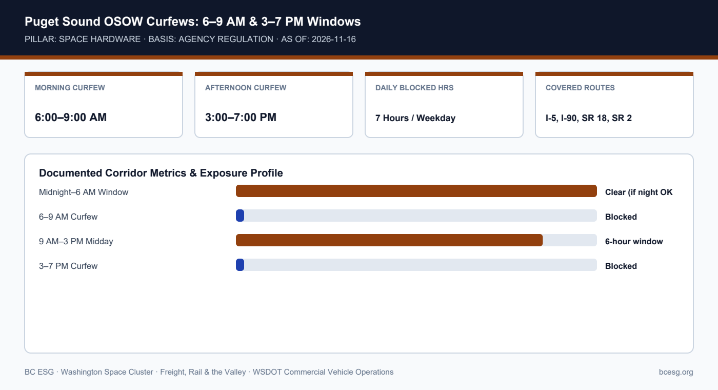
    WSDOT prohibits vehicles displaying 'Oversize Load' signs from operating during weekday 6:00–9:00 AM and 3:00–7:00 PM commuter curfews across Seattle-Everett corridors including I-5, I-90, SR 2, and SR 18.
    Primary Agency / Source: WSDOT Commercial Vehicle Operations  |  As-Of / Horizon: 2026-11-16
    FREIGHT, RAIL & VALLEY · PDF & MARKDOWN TWIN
    Urban OSOW Commuter Curfews — Reference Brief
    Download the 2-page printable reference PDF or read the clean Markdown twin for AI and engineering workflows.
    Puget Sound OSOW Curfews: 6–9 AM & 3–7 PM Windows
    Puget Sound OSOW Curfews: 6–9 AM & 3–7 PM Windows

    Documented Corridor Facts & Continuity Record

    • Special-permit vehicles required to display 'Oversize Load' signs face strict weekday peak commuter curfews in the Seattle-Everett metro region.
    • Standard curfew windows run 6:00–9:00 AM and 3:00–7:00 PM on major corridors including portions of I-5, I-90, SR 2, and SR 18.
    • A truck leaving Kent at 2:15 PM for Moses Lake risks hitting the 3:00 PM SR 18 / I-90 curfew before clearing the metro boundary.

    Daily Dispatch Windows for Oversize Space Hardware

    Time Window (Weekday)StatusDispatch Strategy
    09:00 AM – 03:00 PMOpen (6 hours)Primary daytime clear window for Kent -> I-90
    06:00 AM – 09:00 AMCURFEW BLOCKEDHold at origin or pre-staged yard
    03:00 PM – 07:00 PMCURFEW BLOCKEDDo not release; risk roadside citation

    Operational Exposure & Facility Playbook

    • Build 9:00 AM gate releases into launch-test and satellite-delivery SOPs so drivers clear SR 18 and North Bend well before 3:00 PM.
    • Combine curfew planning with Snoqualmie Pass avalanche-control schedules during winter.
    • Check permit-specific night-travel allowances before scheduling post-7:00 PM departures.

    Connected Valley Cities, Segments & Role Briefs

    Primary Sources & Agency References

  • WSDOT Oversize / Overweight (OSOW) Permits & Superloads: Moving Launch Stages and Tankage

    WSDOT Oversize / Overweight (OSOW) Permits & Superloads: Moving Launch Stages and Tankage

    Thresholds per WSDOT Commercial Vehicle Operations and WA RCW 46.44.

    FREIGHT, RAIL & VALLEY · SPACE HARDWARE · AGENCY REGULATION
    WSDOT OSOW Permits & Superloads
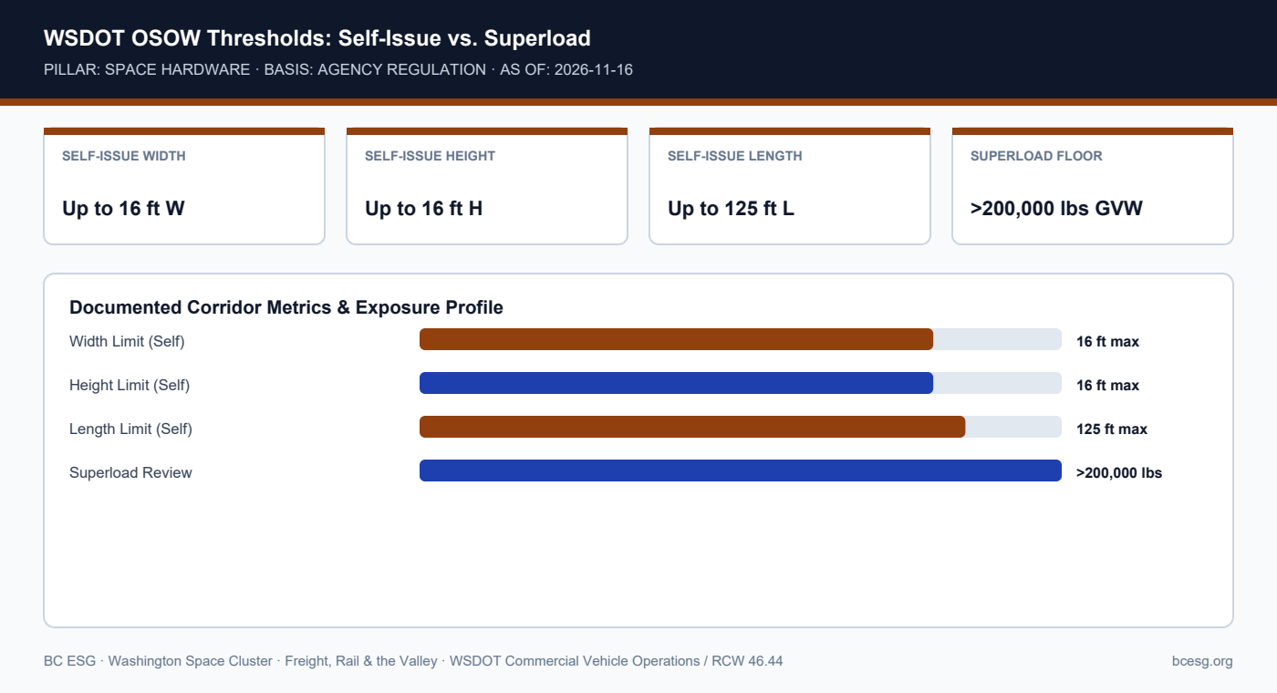
    WSDOT allows self-issued OSOW permits up to 16 ft wide, 16 ft high, 125 ft long, and 200,000 lbs GVW where routes clear—while heavier or taller space hardware triggers multi-week superload engineering reviews.
    Primary Agency / Source: WSDOT Commercial Vehicle Operations / RCW 46.44  |  As-Of / Horizon: 2026-11-16
    FREIGHT, RAIL & VALLEY · PDF & MARKDOWN TWIN
    WSDOT OSOW Permits & Superloads — Reference Brief
    Download the 2-page printable reference PDF or read the clean Markdown twin for AI and engineering workflows.
    WSDOT OSOW Thresholds: Self-Issue vs. Superload
    WSDOT OSOW Thresholds: Self-Issue vs. Superload

    Documented Corridor Facts & Continuity Record

    • Under WA RCW 46.44 and WSDOT Commercial Vehicle Operations rules, carriers moving non-divisible extra-legal loads require Single-Trip, monthly/annual, or Superload permits.
    • Routine self-issue single-trip permits generally cover up to 16 feet wide, 16 feet high, 125 feet long, and 200,000 lbs gross vehicle weight, subject to route clearances.
    • Loads exceeding 200,000 lbs or extreme dimensions require special WSDOT bridge/structural engineering reviews before permit issuance.

    WSDOT OSOW Permit Tiers for Space Hardware

    Permit TierTypical EnvelopeReview Lead TimeHardware Examples
    Self-Issue Single-Trip<=16' W, <=16' H, <=125' L, <=200k lbsSame-day (route clear)Upper stages, small-sat containers
    Superload Permit>200,000 lbs GVW or extreme dimsMulti-week engineeringLarge boosters, autoclaves, GSE

    Operational Exposure & Facility Playbook

    • Design shipping fixtures and transport cradles to stay within the 16' × 16' × 125' × 200k lb envelope whenever possible to avoid superload delays.
    • Never assume a route permitted in summer remains clear in winter when I-90 chain laws or SR 167 flood detours activate.
    • Verify pilot-car / escort and night-move lighting requirements on every permit.

    Connected Valley Cities, Segments & Role Briefs

    Primary Sources & Agency References

  • The Boeing 737 Fuselage Rail Precedent: ~1,700–1,800 Miles and the July 3, 2014 Clark Fork Derailment

    The Boeing 737 Fuselage Rail Precedent: ~1,700–1,800 Miles and the July 3, 2014 Clark Fork Derailment

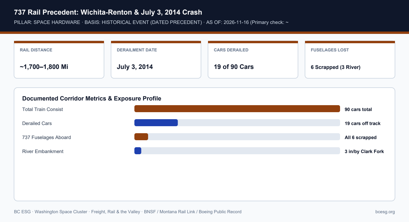
    Primary-source check records ~1,700–1,800 miles (vs. 1,800–2,000 frame shorthand). July 3, 2014 derailment: 19 cars, 6 737 fuselages, 3 down embankment/river, all 6 scrapped.

    FREIGHT, RAIL & VALLEY · SPACE HARDWARE · HISTORICAL EVENT (DATED PRECEDENT)
    737 Fuselage Rail & 2014 Derailment
    Every Boeing 737 fuselage travels ~1,700–1,800 miles by rail from Wichita to Renton; on July 3, 2014, a 19-car Montana Rail Link derailment put three 737 fuselages into the Clark Fork River—the region's benchmark aerospace rail loss.
    Primary Agency / Source: BNSF / Montana Rail Link / Boeing Public Record  |  As-Of / Horizon: 2026-11-16 (Primary check: ~1,700–1,800 mi)
    FREIGHT, RAIL & VALLEY · PDF & MARKDOWN TWIN
    737 Fuselage Rail & 2014 Derailment — Reference Brief
    Download the 2-page printable reference PDF or read the clean Markdown twin for AI and engineering workflows.
    737 Rail Precedent: Wichita-Renton & July 3, 2014 Crash
    737 Rail Precedent: Wichita-Renton & July 3, 2014 Crash

    Documented Corridor Facts & Continuity Record

    • Every Boeing 737 fuselage moves approximately 1,700–1,800 miles by rail from Spirit AeroSystems in Wichita, Kansas, to Boeing's Renton final assembly plant (note: primary-source range is ~1,700–1,800 mi vs. 1,800–2,000 mi informal shorthand).
    • On July 3, 2014, 19 cars of a 90-car Montana Rail Link train derailed near Alberton/Superior, Montana, carrying six 737 fuselages plus 777/747 structures.
    • Three 737 fuselages plunged down the embankment into or beside the Clark Fork River; zero injuries occurred, but all six 737 fuselages were scrapped locally due to structural compromise.

    July 3, 2014 Clark Fork River Aerospace Rail Precedent

    DimensionDocumented FactLesson for Space Hardware
    Route & DistanceWichita, KS to Renton, WA (~1,700–1,800 mi)Long-haul out-of-gauge rail exposes structures to canyon/grade risk
    Derailment ScopeJuly 3, 2014; 19 of 90 cars near Alberton, MTTrack-alignment failures can occur far from origin/destination
    Cargo Loss6 737 fuselages (3 in/by river); all 6 scrappedZero-repair tolerance on flight-critical primary structures

    Operational Exposure & Facility Playbook

    • For Washington launch-vehicle and large-structure builders, the 2014 Renton-bound derailment is the closest public precedent for oversized aerospace rail risk.
    • Primary flight structures subjected to rail shock or water immersion typically cannot be recertified and must be written off as total losses.
    • Ensure transit insurance covers full replacement cost plus schedule-delay spares rather than standard carrier per-pound liability.

    Connected Valley Cities, Segments & Role Briefs

    Primary Sources & Agency References

  • Boeing Field (BFI) & Paine Field (PAE): Specialized Aerospace Charter and Dreamlifter Nodes

    Boeing Field (BFI) & Paine Field (PAE): Specialized Aerospace Charter and Dreamlifter Nodes

    Airport roles per King County International Airport and Paine Field public records; specific private charter contracts are not in our data.

    FREIGHT, RAIL & VALLEY · THE CORRIDORS · AGENCY / AIRPORT RECORD
    BFI & Paine Field Aerospace Air-Bridge
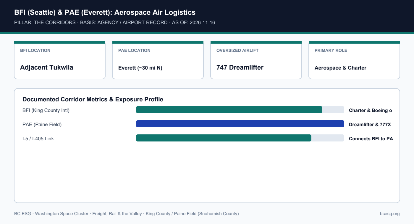
    Unlike commercial Sea-Tac, Boeing Field (BFI) adjacent to Tukwila and Paine Field (PAE) in Everett anchor specialized aerospace charter, flight-test support, and Boeing Dreamlifter oversized structural airlift.
    Primary Agency / Source: King County / Paine Field (Snohomish County)  |  As-Of / Horizon: 2026-11-16
    FREIGHT, RAIL & VALLEY · PDF & MARKDOWN TWIN
    BFI & Paine Field Aerospace Air-Bridge — Reference Brief
    Download the 2-page printable reference PDF or read the clean Markdown twin for AI and engineering workflows.
    BFI (Seattle) & PAE (Everett): Aerospace Air Logistics
    BFI (Seattle) & PAE (Everett): Aerospace Air Logistics

    Documented Corridor Facts & Continuity Record

    • Boeing Field (King County International Airport, BFI) sits just south of downtown Seattle and immediately north of Tukwila, supporting corporate aviation, charter cargo, and Boeing manufacturing logistics.
    • Paine Field (PAE) in Everett sits adjacent to Boeing's wide-body plant and is one of the select global nodes served by the 747-400 Dreamlifter for oversized composite/fuselage structures.
    • Together, BFI and PAE provide specialized aerospace airlift distinct from Sea-Tac's scheduled commercial belly and freighter network.

    Puget Sound Three-Airport Aerospace Cargo Split

    AirportLocationPrimary Cargo / Aerospace RoleValley Connection
    Sea-Tac (SEA)SeaTac (West of Valley)69% of WA air cargo; belly + freighterSR 518 / I-5 / SR 167
    Boeing Field (BFI)South Seattle / Tukwila borderCharter cargo, Boeing logistics, flight testEast Marginal Way / I-5
    Paine Field (PAE)Everett (~30 mi north)Dreamlifter oversized structures, assemblyI-5 / I-405 north

    Operational Exposure & Facility Playbook

    • For urgent oversized aerospace charters that cannot fit standard commercial freighters, BFI offers immediate proximity to Kent and Tukwila.
    • Moving cargo from PAE down to Kent or Renton still crosses the entire Seattle I-5/I-405 metro corridor.
    • Individual space-company charter manifests at BFI or PAE are not in our data.

    Connected Valley Cities, Segments & Role Briefs

    Primary Sources & Agency References

  • Sea-Tac (SEA) Air Cargo: 69% of Washington’s Air Freight Right Above the Green River Valley

    Sea-Tac (SEA) Air Cargo: 69% of Washington’s Air Freight Right Above the Green River Valley

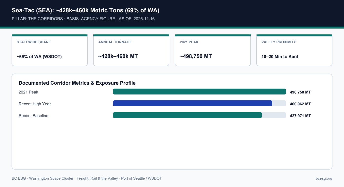
    Air cargo share (69%) and tonnage (~427,971 to 460,062 metric tons; 2021 peak ~498,750 MT) attributed to Port of Seattle and WSDOT.

    FREIGHT, RAIL & VALLEY · THE CORRIDORS · AGENCY FIGURE
    Sea-Tac (SEA) Air Cargo Hub
    Seattle-Tacoma International Airport handles roughly 69% of Washington's air cargo (~428,000–460,000 metric tons annually) via freighters and wide-body belly capacity—sitting minutes west of Tukwila and Kent.
    Primary Agency / Source: Port of Seattle / WSDOT  |  As-Of / Horizon: 2026-11-16
    FREIGHT, RAIL & VALLEY · PDF & MARKDOWN TWIN
    Sea-Tac (SEA) Air Cargo Hub — Reference Brief
    Download the 2-page printable reference PDF or read the clean Markdown twin for AI and engineering workflows.
    Sea-Tac (SEA): ~428k–460k Metric Tons (69% of WA)
    Sea-Tac (SEA): ~428k–460k Metric Tons (69% of WA)

    Documented Corridor Facts & Continuity Record

    • Sea-Tac (SEA) moves roughly 69% of Washington State's total air cargo, handling ~427,971 to 460,062 metric tons in recent years (with a 2021 peak near 498,750 metric tons).
    • Cargo moves through both dedicated all-cargo freighters and wide-body passenger belly-hold capacity.
    • Sitting immediately west of Tukwila and Kent, SEA is the primary rapid-expedite valve for space avionics, flight-computer boards, and AOG-style supplier parts.

    Sea-Tac (SEA) Air Cargo Benchmarks

    MetricDocumented FigureSourceSpace Cluster Use
    WA Air Cargo Share~69% of state totalWSDOTDominant commercial air gateway
    Annual Volume Range~427,971–460,062 MTPort of SeattleAvionics, electronics, expedite
    2021 Pandemic Peak~498,750 MTPort of SeattleUpper historical throughput

    Operational Exposure & Facility Playbook

    • Because SEA sits on the upland plateau west of the Green River Valley, air freighters continue landing even when valley levees breach.
    • Last-mile delivery from SEA into Kent or Auburn still traverses SR 518 / I-5 / SR 167—so valley flood closures can trap cleared air freight at airport CFS warehouses.
    • Pre-clear ITAR/EAR customs brokers at SEA for expedited aerospace electronics.

    Connected Valley Cities, Segments & Role Briefs

    Primary Sources & Agency References

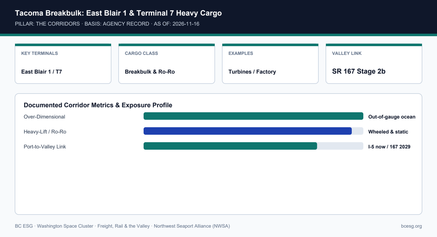
  • Tacoma Breakbulk & Ro-Ro (East Blair 1 / Terminal 7): Moving Non-Containerized Heavy Hardware

    Tacoma Breakbulk & Ro-Ro (East Blair 1 / Terminal 7): Moving Non-Containerized Heavy Hardware

    Breakbulk terminal capabilities per NWSA public terminal documentation.

    FREIGHT, RAIL & VALLEY · THE CORRIDORS · AGENCY RECORD
    Tacoma Breakbulk & Heavy-Lift
    Tacoma Harbor's East Blair 1 and Terminal 7 handle non-containerized, over-dimensional breakbulk and Ro-Ro project cargo—serving as Puget Sound's primary ocean gateway for oversized industrial and aerospace hardware.
    Primary Agency / Source: Northwest Seaport Alliance (NWSA)  |  As-Of / Horizon: 2026-11-16
    FREIGHT, RAIL & VALLEY · PDF & MARKDOWN TWIN
    Tacoma Breakbulk & Heavy-Lift — Reference Brief
    Download the 2-page printable reference PDF or read the clean Markdown twin for AI and engineering workflows.
    Tacoma Breakbulk: East Blair 1 & Terminal 7 Heavy Cargo
    Tacoma Breakbulk: East Blair 1 & Terminal 7 Heavy Cargo

    Documented Corridor Facts & Continuity Record

    • NWSA's Tacoma Harbor operates dedicated breakbulk and roll-on/roll-off (Ro-Ro) facilities at East Blair 1 and Terminal 7.
    • These berths handle non-containerized, over-dimensional project cargo including factory components, large transformers, wind-turbine sections, and specialized aerospace/aviation equipment.
    • Moving out-of-gauge cargo from Tacoma berths to Kent or Auburn requires WSDOT OSOW permits and, until SR 167 Stage 2b opens in 2029, navigation through I-5/Fife interchanges.

    Tacoma Breakbulk vs. Containerized Freight

    ModeNWSA FacilityCargo ProfileInland Permit Need
    Breakbulk / Ro-RoEast Blair 1, Terminal 7 (Tacoma)Out-of-gauge, heavy-lift, staticWSDOT OSOW + escorts
    Containerized (TEU)Seattle & Tacoma terminalsStandard 20’/40′ ISO boxesStandard weight-legal drayage

    Operational Exposure & Facility Playbook

    • Large autoclaves, vacuum chambers, and ground-station pedestals imported by sea typically land via Tacoma breakbulk rather than container berths.
    • Book WSDOT superload engineering reviews weeks ahead of vessel arrival when gross weights exceed 200,000 lbs.
    • Verify overhead utility and bridge clearances between Terminal 7, I-5, and Kent/Auburn plant gates.

    Connected Valley Cities, Segments & Role Briefs

    Primary Sources & Agency References

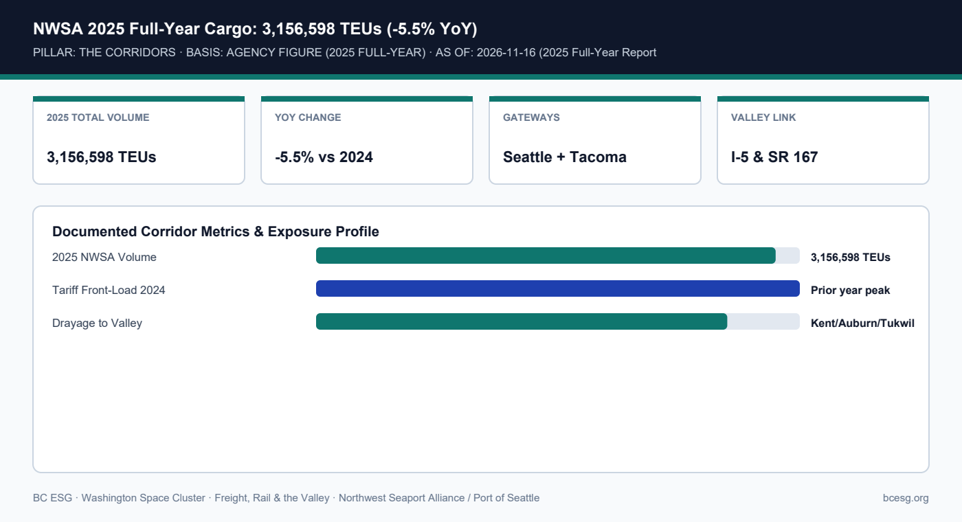
  • Northwest Seaport Alliance (NWSA): 3,156,598 TEUs in 2025 and What It Means for Valley Drayage

    Northwest Seaport Alliance (NWSA): 3,156,598 TEUs in 2025 and What It Means for Valley Drayage

    2025 TEU count (3,156,598) and -5.5% YoY change attributed to NWSA 2025 full-year cargo report.

    FREIGHT, RAIL & VALLEY · THE CORRIDORS · AGENCY FIGURE (2025 FULL-YEAR)
    NWSA 2025 Volume (3.16M TEUs)
    The Northwest Seaport Alliance handled 3,156,598 TEUs in 2025 (down 5.5% from 2024's tariff front-loading surge)—anchoring import/export container drayage into Kent, Auburn, and Tukwila warehouses.
    Primary Agency / Source: Northwest Seaport Alliance / Port of Seattle  |  As-Of / Horizon: 2026-11-16 (2025 Full-Year Report)
    FREIGHT, RAIL & VALLEY · PDF & MARKDOWN TWIN
    NWSA 2025 Volume (3.16M TEUs) — Reference Brief
    Download the 2-page printable reference PDF or read the clean Markdown twin for AI and engineering workflows.
    NWSA 2025 Full-Year Cargo: 3,156,598 TEUs (-5.5% YoY)
    NWSA 2025 Full-Year Cargo: 3,156,598 TEUs (-5.5% YoY)

    Documented Corridor Facts & Continuity Record

    • Per NWSA's 2025 full-year cargo report, the Seattle-Tacoma gateway handled 3,156,598 TEUs—a 5.5% decrease from 2024's front-loaded tariff surge.
    • Containerized raw materials, ground-station electronics, solar-array hardware, and industrial tooling enter through Seattle and Tacoma marine terminals before draying into the Green River Valley.
    • Drayage turns from Seattle (via SR 99/I-5/SR 599) and Tacoma (via I-5/SR 167) depend on unimpeded valley highway and rail-ramp access.

    NWSA Container Gateway Metrics (2025)

    MetricFigureSourceOperational Relevance
    2025 Total Container Volume3,156,598 TEUsNWSA 2025 ReportBaseline gateway throughput
    Year-over-Year Change-5.5% vs. 2024NWSA 2025 ReportPost-tariff front-loading normalization
    Primary Inland DrayageKent / Auburn / TukwilaKing County / WSDOTDependent on I-5 & SR 167

    Operational Exposure & Facility Playbook

    • Time-sensitive satellite or ground-system components arriving in ocean containers face demurrage if SR 167 flood closures block drayage appointments.
    • Use both Seattle and Tacoma terminal options where carrier schedules permit, while noting both feed the same I-5/SR 167 inland funnel.
    • Coordinate customs clearance and ITAR/EAR import-control checks before container discharge to avoid terminal holds.

    Connected Valley Cities, Segments & Role Briefs

    Primary Sources & Agency References

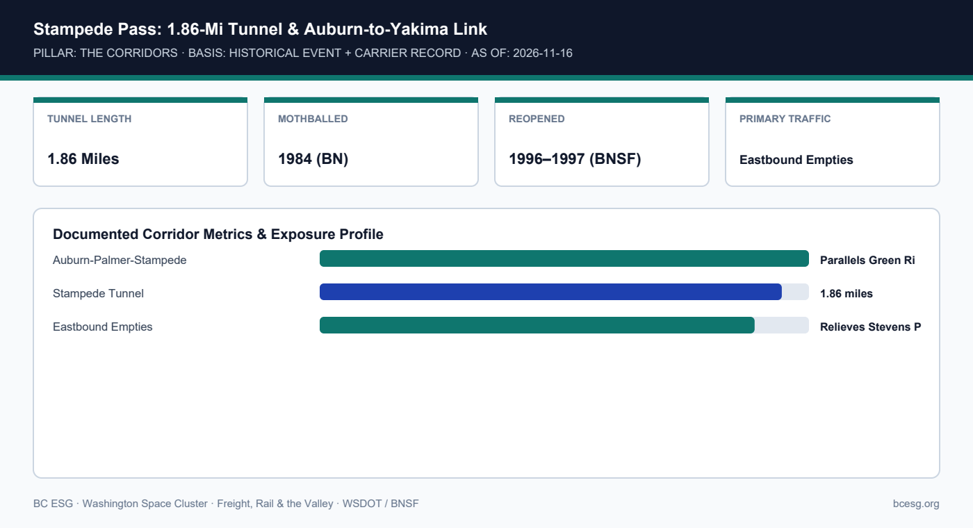
  • Stampede Pass Rail Corridor: From 1984 Mothball to 1996–1997 Reopening Out of Auburn

    Stampede Pass Rail Corridor: From 1984 Mothball to 1996–1997 Reopening Out of Auburn

    Historical reopening dates (1984 mothball, 1996–1997 reopening) and tunnel length (1.86 mi) per WSDOT/rail records.

    FREIGHT, RAIL & VALLEY · THE CORRIDORS · HISTORICAL EVENT + CARRIER RECORD
    Stampede Pass Rail Corridor
    Originating out of Auburn Yard and climbing parallel to the Green River through the 1.86-mile Stampede Tunnel, BNSF's Stampede Subdivision was reopened in 1996–1997 to relieve Stevens Pass congestion.
    Primary Agency / Source: WSDOT / BNSF  |  As-Of / Horizon: 2026-11-16
    FREIGHT, RAIL & VALLEY · PDF & MARKDOWN TWIN
    Stampede Pass Rail Corridor — Reference Brief
    Download the 2-page printable reference PDF or read the clean Markdown twin for AI and engineering workflows.
    Stampede Pass: 1.86-Mi Tunnel & Auburn-to-Yakima Link
    Stampede Pass: 1.86-Mi Tunnel & Auburn-to-Yakima Link

    Documented Corridor Facts & Continuity Record

    • Built by the Northern Pacific in the 1880s and mothballed in 1984, Stampede Pass was rehabilitated and reopened by BNSF in 1996–1997 due to congestion on Stevens Pass.
    • The line exits Auburn Yard/Palmer Junction, runs parallel to the upper Green River, crosses the 1.86-mile Stampede Tunnel, and continues to Yakima and the Tri-Cities.
    • Because of steep Cascade grades, Stampede Pass primarily carries eastbound empty unit trains and manifest freight, freeing Stevens Pass for priority westbound traffic.

    Washington Trans-Cascade Rail Corridors (BNSF)

    CorridorValley ConnectionPrimary RoleConstraint
    Stampede Pass (Subdivision)Auburn Yard / Green RiverEastbound empties & manifestSteep grades; 1.86-mi tunnel
    Stevens Pass (Scenic)Everett / North SoundPriority westbound & intermodalSingle-track Cascade Tunnel
    Columbia River GorgeVancouver, WA (South)Heavy/high-volume flat gradeRequires north-south valley transit

    Operational Exposure & Facility Playbook

    • Understanding BNSF's three-pass directional flow explains why Auburn Yard is vital even for shipments ultimately routed via Stevens Pass or the Gorge.
    • Heavy-haul rail moves originating in the Midwest (like 737 fuselages) typically approach Puget Sound via northern/Gorge routes, while Stampede absorbs return capacity.
    • Upper Green River mudslides or washouts near Palmer/Stampede directly affect Auburn Yard train staging.

    Connected Valley Cities, Segments & Role Briefs

    Primary Sources & Agency References

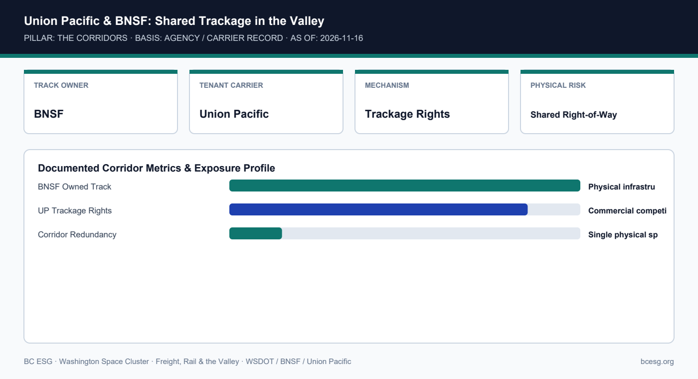
  • Union Pacific Trackage Rights: Dual-Carrier Competition on Shared Valley Rails

    Union Pacific Trackage Rights: Dual-Carrier Competition on Shared Valley Rails

    Trackage-rights structure per WSDOT freight rail documentation.

    FREIGHT, RAIL & VALLEY · THE CORRIDORS · AGENCY / CARRIER RECORD
    Union Pacific Trackage Rights
    Although BNSF owns the physical rail right-of-way through most of the Green River Valley, Union Pacific operates extensively over the same tracks via trackage rights—meaning dual-carrier contracts still share one physical corridor.
    Primary Agency / Source: WSDOT / BNSF / Union Pacific  |  As-Of / Horizon: 2026-11-16
    FREIGHT, RAIL & VALLEY · PDF & MARKDOWN TWIN
    Union Pacific Trackage Rights — Reference Brief
    Download the 2-page printable reference PDF or read the clean Markdown twin for AI and engineering workflows.
    Union Pacific & BNSF: Shared Trackage in the Valley
    Union Pacific & BNSF: Shared Trackage in the Valley

    Documented Corridor Facts & Continuity Record

    • Union Pacific operates freight trains through the Green River Valley to Seattle/Tacoma intermodal terminals and industrial parks via trackage rights on BNSF-owned mainlines.
    • For procurement teams, having both BNSF and Union Pacific quotes creates commercial rate competition—but not physical route redundancy inside the valley.
    • If the valley rail bed floods or suffers a signal/bridge outage, both BNSF and Union Pacific trains stop on the same corridor.

    Commercial vs. Physical Redundancy on Valley Rail

    DimensionBNSFUnion PacificProcurement Reality
    Valley Track OwnershipOwnerTrackage-rights tenantOne physical rail corridor
    Rate / Service ContractingDirect BNSFDirect UPCommercial competition exists
    Valley Flood / WashoutHaltedHaltedZero physical bypass inside valley

    Operational Exposure & Facility Playbook

    • Do not treat 'dual-rail-carrier' status (BNSF + UP) as physical flood resilience for a Kent or Auburn siding.
    • Pair rail contracts with transload backup plans at Tacoma or Spokane/Moses Lake if continuous raw-material flow is critical.
    • Check 49 CFR FRA track-safety and hazmat routing rules when moving regulated industrial inputs.

    Connected Valley Cities, Segments & Role Briefs

    Primary Sources & Agency References

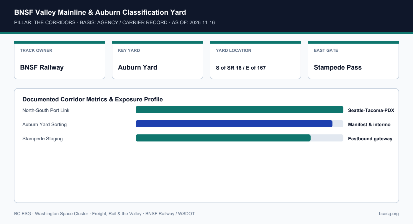
  • BNSF Valley Mainline & Auburn Yard: Classification Hub for Pacific Northwest Heavy Rail

    BNSF Valley Mainline & Auburn Yard: Classification Hub for Pacific Northwest Heavy Rail

    Infrastructure ownership and yard function per WSDOT and BNSF public records.

    FREIGHT, RAIL & VALLEY · THE CORRIDORS · AGENCY / CARRIER RECORD
    BNSF Valley Mainline & Auburn Yard
    BNSF owns the primary north-south rail spine through the Green River Valley and operates Auburn Yard (south of SR 18, east of SR 167) as a core Pacific Northwest classification and transcontinental staging hub.
    Primary Agency / Source: BNSF Railway / WSDOT  |  As-Of / Horizon: 2026-11-16
    FREIGHT, RAIL & VALLEY · PDF & MARKDOWN TWIN
    BNSF Valley Mainline & Auburn Yard — Reference Brief
    Download the 2-page printable reference PDF or read the clean Markdown twin for AI and engineering workflows.
    BNSF Valley Mainline & Auburn Classification Yard
    BNSF Valley Mainline & Auburn Classification Yard

    Documented Corridor Facts & Continuity Record

    • BNSF owns and operates the primary north-south mainline tracks running through Tukwila, Kent, and Auburn, connecting the Ports of Seattle and Tacoma to Portland and transcontinental corridors.
    • Auburn Yard, sited south of SR 18 and east of SR 167 in the historic Green/White River floodplain, classifies intermodal containers, manifest freight, and bulk cars.
    • Auburn Yard serves as the western staging ground for trains climbing the Cascade Range via Stampede Pass.

    BNSF Green River Valley Rail Assets

    AssetLocationFunctionExposure
    Valley MainlineTukwila–Kent–AuburnNorth-south port & interstate railSits on valley floodplain grade
    Auburn YardSouth Auburn (SR 18 / SR 167)Classification & train assemblyHistoric Green/White floodplain
    Renton Industrial SpurRenton737 fuselage delivery spurSingle-spur urban dependency

    Operational Exposure & Facility Playbook

    • While small-satellite and electronics firms ship by truck or air, heavy metallic raw stock, tooling, and large structures rely on BNSF rail continuity.
    • A flood closure or derailment at Auburn Yard ripples across both north-south port drayage and eastbound transcontinental returns.
    • Verify whether critical tier-1 metal or composite suppliers depend on BNSF carload service through Auburn.

    Connected Valley Cities, Segments & Role Briefs

    Primary Sources & Agency References

  • I-90 Snoqualmie Pass: Winter Chain Laws, Avalanche Controls, and Automatic OSOW Prohibitions

    I-90 Snoqualmie Pass: Winter Chain Laws, Avalanche Controls, and Automatic OSOW Prohibitions

    WSDOT pass and OSOW permit rules verified against WSDOT Commercial Vehicles and Mountain Passes portals.

    FREIGHT, RAIL & VALLEY · THE CORRIDORS · AGENCY REGULATION
    I-90 Snoqualmie Pass Winter Rules
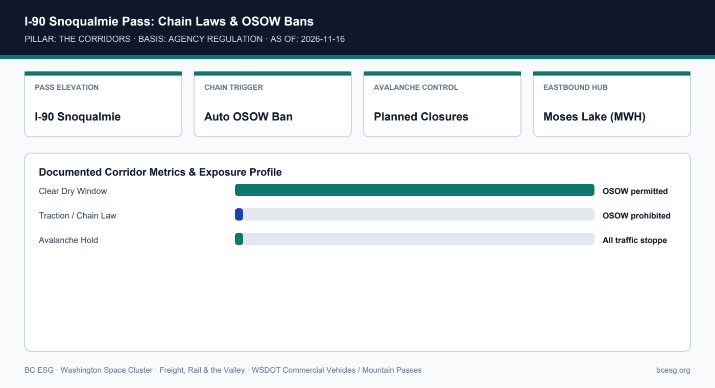
    Every truck moving test hardware between Puget Sound and Moses Lake crosses I-90 Snoqualmie Pass—where WSDOT automatically prohibits special-permit oversize/overweight loads whenever chain or traction restrictions activate.
    Primary Agency / Source: WSDOT Commercial Vehicles / Mountain Passes  |  As-Of / Horizon: 2026-11-16
    FREIGHT, RAIL & VALLEY · PDF & MARKDOWN TWIN
    I-90 Snoqualmie Pass Winter Rules — Reference Brief
    Download the 2-page printable reference PDF or read the clean Markdown twin for AI and engineering workflows.
    I-90 Snoqualmie Pass: Chain Laws & OSOW Bans
    I-90 Snoqualmie Pass: Chain Laws & OSOW Bans

    Documented Corridor Facts & Continuity Record

    • WSDOT OSOW permit rules strictly prohibit special-permit oversize/overweight movements whenever mountain-pass signs indicate traction or chain requirements.
    • When Snoqualmie Pass posts 'Chains required on vehicles over 10,000 GVW' or similar snow/ice restrictions, oversize aerospace loads must park and wait until restrictions lift.
    • WSDOT also conducts scheduled winter avalanche-control closures on I-90, halting all commercial traffic.

    I-90 Snoqualmie Pass Operational Matrix

    Pass ConditionStandard FreightSpecial-Permit OSOWDispatch Action
    No RestrictionsOpenPermitted (subject to curfew)Normal transit to Moses Lake
    Traction / Chain Law ActiveOpen with chainsPROHIBITEDStage at North Bend / Cle Elum
    Avalanche Control / ClosureCLOSEDCLOSEDHold at origin or wait out

    Operational Exposure & Facility Playbook

    • Winter test campaigns at Moses Lake (such as Stoke Space testing) face multi-day road delays if oversize hardware moves without weather buffers.
    • Never schedule just-in-time winter OSOW hardware deliveries across I-90 without a pre-identified heated/secure staging yard.
    • Monitor WSDOT real-time mountain pass feeds 24 hours prior to release.

    Connected Valley Cities, Segments & Role Briefs

    Primary Sources & Agency References

BC ESG

ESG Strategy, Sustainability Intelligence, and Business Continuity for Forward-Thinking Organizations

© 2026 BC ESG — Business Continuity, ESG & Sustainability Intelligence